
Insured Buying
This report has a service guarantee. We stand by our report quality.
The U.S. Airborne LiDAR Market size was estimated at USD 650 million in 2023 and is projected to reach USD 1.2 billion by 2030, exhibiting a compound annual growth rate (CAGR) of 9.50% during the forecast period (2024-2030).
| Study Period | 2018 - 2030 |
| Base Year For Estimation | 2023 |
| Forecast Data Period | 2024 - 2030 |
| CAGR (2024-2030) | 9.50% |
| 2023 Market Size | USD 650 million |
| 2030 Market Size | USD 1.2 billion |
| Key Players | Leica Geosystems, Teledyne Optech, RIEGL, Trimble, Sick |
The U.S. Airborne LiDAR market represents a critical segment within the broader geospatial and remote sensing industry, with significant ties to the semiconductor and electronics sector through its reliance on advanced sensor technology, data processing units, and navigation systems. This market encompasses the deployment of Light Detection and Ranging systems mounted on various aerial platforms, including manned aircraft, helicopters, and unmanned aerial vehicles (UAVs or drones), to capture high-resolution three-dimensional data about the Earth's surface and man-made structures. The technology functions by emitting laser pulses and measuring the time it takes for the reflected light to return to the sensor, enabling the creation of precise digital elevation models and point clouds. In the United States, the adoption of Airborne LiDAR is driven by its unparalleled accuracy and efficiency in data collection compared to traditional surveying methods. Key end-users span both public and private sectors, including government agencies for national mapping and disaster management, engineering firms for infrastructure projects, environmental consultants for natural resource management, and the energy sector for pipeline monitoring and site planning. The integration of LiDAR with other technologies, such as photogrammetry and inertial measurement units (IMUs), has further enhanced its capabilities, making it an indispensable tool for a wide array of applications. The market is characterized by continuous technological advancements, particularly in sensor miniaturization, increased point density, and improved data processing algorithms, which are expanding its applicability and driving growth. Companies like Teledyne Optech, Leica Geosystems, and RIEGL are prominent players providing cutting-edge LiDAR systems, while numerous service providers offer specialized data acquisition and processing solutions. The regulatory environment, including Federal Aviation Administration (FAA) guidelines for UAV operations, also plays a crucial role in shaping market dynamics. Overall, the U.S. Airborne LiDAR market is a dynamic and evolving field, underpinned by innovation and growing demand for high-precision geospatial data across multiple industries.
The U.S. Airborne LiDAR market is distinguished by several key highlights that underscore its importance and growth trajectory. One of the foremost aspects is the technological sophistication of modern LiDAR systems, which feature enhanced capabilities such as higher pulse repetition rates, multiple return detection, and full-waveform digitization, allowing for detailed vegetation penetration and infrastructure modeling. The miniaturization of components, driven by advancements in semiconductor technology, has enabled the deployment of LiDAR on smaller UAV platforms, drastically reducing costs and increasing accessibility for a broader range of applications. Another significant highlight is the integration of artificial intelligence and machine learning algorithms in data processing software, which automates feature extraction, classification, and analysis, thereby improving efficiency and reducing the time required to deliver actionable insights. The market is also witnessing a surge in demand from emerging applications, including autonomous vehicle development, where high-definition mapping is essential, and renewable energy projects, such as wind farm site planning and solar potential analysis. Furthermore, government initiatives and federal funding for national mapping programs, like the USGS 3D Elevation Program (3DEP), provide a steady stream of projects and foster long-term market stability. The competitive landscape is marked by both established corporations and innovative startups focusing on niche segments, driving continuous improvement and customization of solutions. Partnerships between hardware manufacturers, software developers, and service providers are common, creating integrated offerings that deliver end-to-end solutions to clients. Additionally, the emphasis on sustainability and environmental monitoring is opening new avenues for LiDAR in carbon sequestration assessment, coastal zone management, and flood risk modeling. These highlights collectively position the U.S. Airborne LiDAR market as a high-growth, technology-driven sector with expanding opportunities across diverse industries.
The growth of the U.S. Airborne LiDAR market is propelled by a combination of drivers, while also facing certain restraints, yet presenting numerous opportunities for expansion. A primary driver is the increasing demand for high-accuracy geospatial data across various sectors, including urban planning, transportation, and agriculture, where precise topographic information is crucial for decision-making and operational efficiency. The advancement in semiconductor technology, which enables the production of more efficient and cost-effective LiDAR sensors, is another significant driver, making the technology more accessible to small and medium-sized enterprises. Government investments in infrastructure development and national security applications also stimulate market growth, as agencies utilize LiDAR for mapping, monitoring, and disaster response initiatives. However, the market encounters restraints such as the high initial investment required for LiDAR systems and data processing software, which can be a barrier for some potential users. Regulatory challenges related to airspace permissions for UAV operations, particularly in densely populated or restricted areas, can also limit deployment flexibility. Additionally, the complexity of data processing and the need for specialized expertise to interpret LiDAR data pose challenges in terms of workforce training and operational costs. Despite these restraints, the market presents substantial opportunities. The expansion of applications in autonomous vehicles and smart city projects offers significant growth potential, as these areas rely heavily on precise 3D mapping. The integration of LiDAR with other emerging technologies, such as 5G for real-time data transmission and Internet of Things (IoT) for environmental sensing, opens new avenues for innovation. Furthermore, the increasing focus on climate change and natural resource management is driving demand for LiDAR in environmental monitoring and conservation efforts, creating new market segments. Overall, while challenges exist, the drivers and opportunities indicate a positive outlook for the U.S. Airborne LiDAR market.
The concentration of the U.S. Airborne LiDAR market is characterized by the presence of both leading global players and specialized regional firms, creating a competitive yet collaborative environment. Major companies such as Teledyne Optech, Leica Geosystems (part of Hexagon), and RIEGL Laser Measurement Systems dominate the hardware segment, offering a range of airborne LiDAR systems known for their reliability, accuracy, and advanced features. These corporations have extensive research and development capabilities, continuously introducing innovations in sensor technology, such as multi-spectral LiDAR and enhanced range capabilities. In addition to hardware manufacturers, there is a significant concentration of service providers and data processing firms, including Woolpert, Dewberry, and Quantum Spatial, which offer end-to-end solutions from data acquisition to analysis and reporting. These companies often work on large-scale projects for government agencies and private clients, leveraging their expertise and established reputations. The market also includes a growing number of startups and niche players focusing on specific applications or technological advancements, such as UAV-based LiDAR services or AI-driven data analytics, which add dynamism and innovation to the sector. Geographically, activity is concentrated in regions with high demand for geospatial services, such as the West Coast for technology and autonomous vehicle development, the Gulf Coast for energy infrastructure, and the Northeast for urban planning and environmental projects. Collaboration is common, with partnerships between hardware suppliers, software developers, and service providers to deliver comprehensive solutions. This concentration structure ensures a robust ecosystem where innovation thrives, and clients have access to a wide range of options tailored to their specific needs.
In the U.S. Airborne LiDAR market, systems are categorized based on their technical specifications and deployment characteristics, primarily into topographic and bathymetric LiDAR, as well as distinctions based on waveform processing and platform type. Topographic LiDAR is the most widely used type, employing near-infrared lasers to map land surfaces, vegetation, and built environments with high precision. It is extensively applied in urban planning, forestry, and engineering projects where detailed terrain models are required. Bathymetric LiDAR, on the other hand, utilizes green light lasers that penetrate water to measure seafloor and riverbed elevations, making it invaluable for coastal zone management, hydrographic surveying, and underwater infrastructure inspection. Another classification is based on waveform processing: discrete return systems capture individual points of reflection, suitable for most standard applications, while full-waveform systems record the entire reflected signal, providing richer data for complex environments like dense forests or urban canyons. Platform-wise, LiDAR systems are deployed on manned aircraft, which offer endurance and capacity for large-area mapping, and increasingly on UAVs, which provide flexibility, lower costs, and access to difficult or hazardous terrains. The choice of system type depends on project requirements, including accuracy needs, area coverage, environmental conditions, and budget constraints. Technological trends are leading towards the development of multi-spectral LiDAR, which uses multiple laser wavelengths to capture additional information about surface materials, and single-photon LiDAR, which offers higher efficiency and faster data acquisition. These advancements are expanding the applicability of Airborne LiDAR, enabling more sophisticated analyses and driving adoption across diverse sectors.
The applications of Airborne LiDAR in the U.S. are diverse and expanding, driven by the technology's ability to deliver high-resolution, accurate geospatial data quickly and efficiently. In the infrastructure sector, LiDAR is used for transportation planning, highway design, and railway corridor mapping, enabling engineers to create detailed digital terrain models that inform construction and maintenance activities. The energy industry leverages LiDAR for pipeline route planning, monitoring, and integrity assessment, as well as for site selection and layout optimization in renewable energy projects like wind farms and solar installations. Environmental applications include forestry management, where LiDAR data helps in biomass estimation, canopy height measurement, and wildfire risk assessment, and hydrology, for floodplain mapping, watershed analysis, and dam safety inspections. Urban planning and smart city initiatives utilize LiDAR for 3D city modeling, building information modeling (BIM), and utility mapping, facilitating better design and management of urban environments. The technology is also critical in archaeology and cultural heritage preservation, providing non-invasive means to discover and document historical sites. Furthermore, the advent of autonomous vehicles has created a significant new application, with LiDAR being essential for high-definition mapping and real-time navigation. Disaster management agencies use LiDAR for pre- and post-event assessment in earthquakes, hurricanes, and landslides, enabling effective response and recovery planning. The mining and aggregates industry applies LiDAR for volume calculations, slope stability analysis, and site monitoring. Each application benefits from LiDAR's precision, speed, and ability to operate in various conditions, making it a versatile tool across numerous fields.
The adoption and utilization of Airborne LiDAR technology in the United States exhibit regional variations influenced by factors such as economic activity, regulatory frameworks, and geographic needs. The West Coast, particularly California, is a hub for technological innovation and early adoption, driven by the presence of major tech companies, autonomous vehicle developers, and a strong focus on environmental conservation. This region sees extensive use of LiDAR in Silicon Valley for autonomous driving research, in forestry management in the Pacific Northwest, and in urban planning for densely populated areas like Los Angeles and San Francisco. The Gulf Coast region, including Texas and Louisiana, has high demand from the energy sector, with LiDAR applications in oil and gas pipeline monitoring, offshore exploration, and refinery site planning, as well as in coastal management due to vulnerability to hurricanes and erosion. The Northeast, encompassing states like New York and Massachusetts, utilizes LiDAR primarily for infrastructure projects, transportation planning, and environmental compliance in urban corridors, alongside applications in historical preservation and academic research. The Midwest, with its agricultural dominance, employs LiDAR for farmland management, soil conservation, and floodplain mapping along major river systems like the Mississippi. Mountain states such as Colorado and Utah focus on natural resource management, mining, and recreation planning in national parks. Federal initiatives like the USGS 3D Elevation Program ensure nationwide coverage, but regional priorities shape specific deployments, with local government agencies, private firms, and research institutions driving demand based on unique regional challenges and opportunities.
The competitive landscape of the U.S. Airborne LiDAR market includes a mix of established multinational corporations and specialized domestic firms, each contributing to innovation and service delivery. Teledyne Optech is a leading player, known for its robust and versatile LiDAR systems like the Orion and Galaxy series, which are widely used in topographic and bathymetric applications. Leica Geosystems, part of Hexagon, offers the ALS series of airborne sensors, recognized for their high accuracy and integration with photogrammetric systems, catering to sectors such as surveying and mapping. RIEGL Laser Measurement Systems is renowned for its high-performance LiDAR instruments, including the VQ and LMS series, which feature advanced waveform processing and are popular in scientific research and precise terrain mapping. In addition to hardware manufacturers, key service providers include Woolpert, a U.S.-based firm with extensive experience in aerial surveying and geospatial solutions for government and commercial clients, and Dewberry, which provides comprehensive LiDAR data acquisition and processing services, particularly for federal and state projects. Quantum Spatial (now part of NV5 Geospatial) is another significant player, offering end-to-end geospatial services with a focus on large-scale mapping and environmental applications. Emerging companies like Phoenix LiDAR Systems specialize in UAV-based LiDAR solutions, providing flexible and cost-effective options for smaller projects. These companies often engage in strategic partnerships, mergers, and acquisitions to expand their capabilities and market reach. Innovation is continuous, with investments in R&D to enhance sensor performance, reduce size and weight, and improve data processing efficiency, ensuring that the market remains dynamic and responsive to evolving client needs.
Recent developments in the U.S. Airborne LiDAR market reflect ongoing technological advancements and strategic movements aimed at enhancing capabilities and expanding market reach. One significant trend is the increased adoption of UAV-based LiDAR systems, driven by improvements in drone technology, regulatory approvals for beyond visual line of sight (BVLOS) operations, and the need for cost-effective, rapid data acquisition. Companies are launching new sensors with higher accuracy and smaller form factors, such as Teledyne Optech's CL-360 for UAVs and RIEGL's miniVUX series, enabling more precise and accessible mapping. Another development is the integration of artificial intelligence and machine learning in data processing software, which automates feature extraction, classification, and anomaly detection, reducing processing time and improving accuracy for applications like utility mapping and vegetation management. Strategic partnerships and acquisitions are also prevalent; for instance, NV5 Global's acquisition of Quantum Spatial has created a larger entity with enhanced service offerings, while collaborations between hardware manufacturers and software firms aim to provide seamless end-to-end solutions. There is growing emphasis on sustainability, with LiDAR being used more frequently in environmental monitoring projects, such as carbon stock assessment in forests and coastal resilience planning, supported by government funding and initiatives. Additionally, the market is seeing increased interest from the autonomous vehicle sector, where high-definition LiDAR mapping is essential for navigation systems, prompting investments and pilot projects across the country. These developments indicate a market that is not only growing but also evolving to meet the demands of modern applications, with a focus on innovation, efficiency, and sustainability.
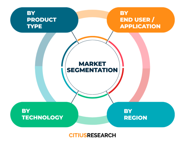
The segmentation of the U.S. Airborne LiDAR market is typically based on several criteria to provide a detailed understanding of its components and dynamics. By type, the market is divided into topographic LiDAR and bathymetric LiDAR, each serving distinct applications and requiring specific sensor characteristics. Topographic LiDAR is further segmented based on technology, such as discrete return and full-waveform systems, which differ in data capture and processing methods. Platform segmentation includes manned aircraft and unmanned aerial vehicles (UAVs), with the latter gaining prominence due to operational flexibility and cost advantages. Application-based segmentation covers a wide range of uses, including corridor mapping for infrastructure projects, forestry and agriculture, mining and construction, environmental monitoring, urban planning, and disaster management. Each application segment has unique requirements driving the choice of LiDAR system and service provider. Geographically, the market can be segmented into regions such as the West, South, Midwest, and Northeast, reflecting varying demand patterns influenced by local industries and natural features. Additionally, the market is segmented by end-user, including government agencies, commercial enterprises, and research institutions, each with different procurement processes and project scales. This multi-faceted segmentation allows for a comprehensive analysis of market trends, opportunities, and competitive landscapes, enabling stakeholders to identify niche areas and tailor their strategies accordingly. Understanding these segments is crucial for companies operating in or entering the market, as it helps in targeting the right customers, developing appropriate products, and optimizing resource allocation.
What is Airborne LiDAR and how does it work? Airborne LiDAR is a remote sensing technology that uses laser pulses to measure distances to the Earth's surface, creating precise 3D models. It works by emitting laser light from an aircraft or drone and measuring the time it takes for the reflection to return, calculating distance based on the speed of light.
What are the main applications of Airborne LiDAR? Key applications include topographic mapping, infrastructure planning, environmental monitoring, forestry management, urban development, disaster assessment, and autonomous vehicle navigation, due to its high accuracy and efficiency in data collection.
What are the advantages of using Airborne LiDAR over traditional surveying methods? Advantages include faster data acquisition, higher accuracy and density of points, ability to penetrate vegetation, and coverage of large areas quickly, making it more efficient and cost-effective for many projects.
How is Airborne LiDAR used in autonomous vehicles? It provides high-definition 3D maps essential for navigation, obstacle detection, and path planning, enabling vehicles to perceive their environment with precision and operate safely.
What types of platforms are used for Airborne LiDAR deployment? Platforms include manned aircraft like planes and helicopters for large-area mapping, and unmanned aerial vehicles (drones) for smaller, more flexible operations in accessible or hazardous terrains.
What is the difference between topographic and bathymetric LiDAR? Topographic LiDAR uses near-infrared lasers for land surface mapping, while bathymetric LiDAR uses green light to penetrate water and map underwater surfaces, catering to different environmental and project needs.
Citius Research has developed a research report titled “U.S. Airborne LiDAR Market Report - Industry Analysis, Size, Share, Growth Trends, Regional Outlook, Competitive Strategies and Segment Forecasts 2024 - 2030” delivering key insights regarding business intelligence and providing concrete business strategies to clients in the form of a detailed syndicated report. The report details out the factors such as business environment, industry trend, growth opportunities, competition, pricing, global and regional market analysis, and other market related factors.
• U.S. Airborne LiDAR Market Potential
• Segment-wise breakup
• Compounded annual growth rate (CAGR) for the next 6 years
• Key customers and their preferences
• Market share of major players and their competitive strength
• Existing competition in the market
• Price trend analysis
• Key trend analysis
• Market entry strategies
• Market opportunity insights
The report focuses on the drivers, restraints, opportunities, and challenges in the market based on various factors geographically. Further, key players, major collaborations, merger & acquisitions along with trending innovation and business policies are reviewed in the report. The U.S. Airborne LiDAR Market report is segmented on the basis of various market segments and their analysis, both in terms of value and volume, for each region for the period under consideration.
• North America
• Latin America
• Europe
• MENA
• Asia Pacific
• Sub-Saharan Africa and
• Australasia
The report covers below mentioned analysis, but is not limited to:
• Overview of U.S. Airborne LiDAR Market
• Research Methodology
• Executive Summary
• Market Dynamics of U.S. Airborne LiDAR Market
• Driving Factors
• Restraints
• Opportunities
• Global Market Status and Forecast by Segment A
• Global Market Status and Forecast by Segment B
• Global Market Status and Forecast by Segment C
• Global Market Status and Forecast by Regions
• Upstream and Downstream Market Analysis of U.S. Airborne LiDAR Market
• Cost and Gross Margin Analysis of U.S. Airborne LiDAR Market
• U.S. Airborne LiDAR Market Report - Industry Analysis, Size, Share, Growth Trends, Regional Outlook, Competitive Strategies and Segment Forecasts 2024 - 2030
• Competition Landscape
• Market Share of Major Players
• Key Recommendations
The “U.S. Airborne LiDAR Market Report - Industry Analysis, Size, Share, Growth Trends, Regional Outlook, Competitive Strategies and Segment Forecasts 2024 - 2030” report helps the clients to take business decisions and to understand strategies of major players in the industry. The report delivers the market driven results supported by a mix of primary and secondary research. The report provides the results triangulated through authentic sources and upon conducting thorough primary interviews with the industry experts. The report includes the results on the areas where the client can focus and create point of parity and develop a competitive edge, based on real-time data results.
Below are the key stakeholders for the U.S. Airborne LiDAR Market:
• Manufacturers
• Distributors/Traders/Wholesalers
• Material/Component Manufacturers
• Industry Associations
• Downstream vendors
| Report Attribute | Details |
| Base year | 2023 |
| Historical data | 2018 – 2023 |
| Forecast | 2024 - 2030 |
| CAGR | 2024 - 2030 |
| Quantitative Units | Value (USD Million) |
| Report coverage | Revenue Forecast, Competitive Landscape, Growth Factors, Trends and Strategies. Customized report options available on request |
| Segments covered | Product type, technology, application, geography |
| Regions covered | North America, Latin America, Europe, MENA, Asia Pacific, Sub-Saharan Africa and Australasia |
| Countries covered | US, UK, China, Japan, Germany, India, France, Brazil, Italy, Canada, Russia, South Korea, Australia, Spain, Mexico and others |
| Customization scope | Available on request |
| Pricing | Various purchase options available as per your research needs. Discounts available on request |
• To describe and forecast the U.S. Airborne LiDAR Market size, on the basis of various segmentations and geography, in terms of value and volume
• To measure the changing needs of customers/industries
• To provide detailed information regarding the drivers, restraints, opportunities, and challenges influencing the growth of the market
• To gain competitive intelligence and uncover new opportunities
• To analyse opportunities in the market for stakeholders by identifying high-growth segments in U.S. Airborne LiDAR Market
• To strategically profile key players and provide details of the current competitive landscape
• To analyse strategic approaches adopted by players in the market, such as product launches and developments, acquisitions, collaborations, contracts, expansions, and partnerships
Citius Research provides free customization of reports as per your need. This report can be personalized to meet your requirements. Get in touch with our sales team, who will guarantee you to get a report that suits your necessities.

We follow a robust research methodology to analyze the market in order to provide our clients with qualitative and quantitative analysis which has a very low or negligible deviance. Extensive secondary research supported by primary data collection methods help us to thoroughly understand and gauge the market. We incorporate both top-down and bottom-up approach for estimating the market. The below mentioned methods are then adopted to triangulate and validate the market.
Secondary research includes sources such as published books, articles in journals, news media and published businesses, government and international body publications, and associations. Sources also include paid databases such as Hoovers, Thomson Reuters, Passport and others. Data derived through secondary sources is further validated through primary sources. The secondary sources also include major manufacturers mapped on the basis of revenues, product portfolios, and sales channels.
Primary data collection methods include conducting interviews with industry experts and various stakeholders across the supply chain, such as raw material suppliers, manufacturers, product distributors and customers. The interviews are either telephonic or face-to-face, or even a combination of both. Prevailing trends in the industry are gathered by conducting surveys. Primary interviews also help us to understand the market drivers, restraints and opportunities, along with the challenges in the market. This method helps us in validating the data gathered through secondary sources, further triangulating the data and developing it through our statistical tools. We generally conduct interviews with -
Supply side analysis is based on the data collected from the manufacturers and the product providers in terms of their segmental revenues. Secondary sources for this type of analysis include company annual reports and publications, associations and organisations, government publications and others.
Demand side analysis is based upon the consumer insights who are the end users of the particular product in question. They could be an individual user or an organisation. Such data is gathered through consumer surveys and focused group interviews.
As a primary step, in order to develop the market numbers we follow a vigorous methodology that includes studying the parent market of the niche product and understanding the industry trends, acceptance among customers of the product, challenges, future growth, and others, followed by further breaking down the market under consideration into various segments and sub-markets. Additionally, in order to cross-validate the market, we also determine the top players in the market, along with their segmental revenues for the said market. Our secondary sources help us to validate the market share of the top players. Using both the qualitative and quantitative analysis of all the possible factors helps us determine the market numbers which are inclined towards accuracy.
Request a detailed Research Methodology for the market.
Citius Research has developed a research report titled “X-ray Security Screening Market Report - Global Industry Analysis, Size, Share, Growth Trends, Regional Outlook, Competitive Strategies and Segment Forecas... Read More »
Citius Research has developed a research report titled “Wirewound Variable Resistors Market Report - Global Industry Analysis, Size, Share, Growth Trends, Regional Outlook, Competitive Strategies and Segment For... Read More »
Citius Research has developed a research report titled “Wireless Video Surveillance Market Report - Global Industry Analysis, Size, Share, Growth Trends, Regional Outlook, Competitive Strategies and Segment Fore... Read More »
Citius Research has developed a research report titled “Wireless Chipset Market Report - Global Industry Analysis, Size, Share, Growth Trends, Regional Outlook, Competitive Strategies and Segment Forecasts 2024 ... Read More »
Citius Research has developed a research report titled “Wireless Car Charging Market Report - Global Industry Analysis, Size, Share, Growth Trends, Regional Outlook, Competitive Strategies and Segment Forecasts ... Read More »
The Pet Snacks and Treats Market is witnessing remarkable growth within the pet care sector, due to the rising demand for delectable and healthy treats for pet animals. This market provides pet owners with a vari... Read More »
The creatine gummies market represents a small but rising niche within the broader sports nutrition sector. Creatine gummies provide an alternative delivery format to powders for the muscle strength and performance bo... Read More »
Citius Research has developed a research report titled “Yield Monitoring Systems Market Report - Global Industry Analysis, Size, Share, Growth Trends, Regional Outlook, Competitive Strategies and Segment Forecas... Read More »
Citius Research has developed a research report titled “XRF Analyzer Market Report - Global Industry Analysis, Size, Share, Growth Trends, Regional Outlook, Competitive Strategies and Segment Forecasts 2024 - 20... Read More »
Citius Research has developed a research report titled “Wound Measurement Devices Market Report - Global Industry Analysis, Size, Share, Growth Trends, Regional Outlook, Competitive Strategies and Segment Foreca... Read More »