
Insured Buying
This report has a service guarantee. We stand by our report quality.
The Airborne LiDAR Market size was estimated at USD 1.45 billion in 2023 and is projected to reach USD 2.65 billion by 2030, exhibiting a compound annual growth rate (CAGR) of 9.00% during the forecast period (2024-2030).
| Study Period | 2018 - 2030 |
| Base Year For Estimation | 2023 |
| Forecast Data Period | 2024 - 2030 |
| CAGR (2024-2030) | 9.00% |
| 2023 Market Size | USD 1.45 billion |
| 2030 Market Size | USD 2.65 billion |
| Key Players | Leica Geosystems, Teledyne Optech, RIEGL, Trimble, Sick AG |
The Airborne LiDAR market represents a critical segment within the semiconductor and electronics industry, focusing on advanced remote sensing technologies that utilize laser light to measure distances and generate precise, high-resolution three-dimensional information about the Earth's surface and man-made structures. This technology is primarily deployed from aircraft, drones, and helicopters, enabling extensive data collection over large and often inaccessible areas with remarkable accuracy and efficiency. The market is characterized by rapid technological advancements, increasing adoption across diverse sectors, and a growing emphasis on geospatial data for informed decision-making. Key components include laser scanners, inertial measurement units, GPS receivers, and sophisticated software for data processing and analysis. The integration of LiDAR with other sensor technologies and the expansion of applications beyond traditional surveying and mapping are driving market evolution. Companies operating in this space are continuously innovating to enhance system performance, reduce costs, and improve data processing capabilities, catering to the escalating demand for high-quality geospatial information.
Industries such as forestry, agriculture, urban planning, infrastructure development, and environmental monitoring are significant adopters of Airborne LiDAR systems. The technology's ability to penetrate vegetation and provide detailed terrain models makes it indispensable for applications like flood risk assessment, carbon stock estimation, and pipeline monitoring. The market is also witnessing increased utilization in autonomous vehicles and smart city projects, further broadening its scope. Regulatory support for infrastructure development and disaster management initiatives in various regions is fostering market growth. Additionally, the declining cost of LiDAR sensors, driven by advancements in semiconductor manufacturing, is making the technology more accessible to a wider range of users. The competitive landscape is dynamic, with numerous established players and new entrants striving to capture market share through product innovation, strategic partnerships, and expansion into emerging applications and geographic markets.
A prominent highlight of the Airborne LiDAR market is the accelerating integration of artificial intelligence and machine learning algorithms into data processing workflows. These technologies are revolutionizing how raw LiDAR data is interpreted, enabling automated feature extraction, classification, and anomaly detection with unprecedented speed and accuracy. This reduces the time and expertise required to derive actionable insights from vast datasets, making LiDAR technology more practical for time-sensitive applications such as disaster response and construction monitoring. Another key highlight is the proliferation of drone-based LiDAR systems, which offer a cost-effective and flexible alternative to traditional manned aircraft deployments. Drones can access difficult terrains and operate at lower altitudes, capturing higher resolution data while minimizing operational costs and environmental impact. This has democratized access to high-precision geospatial data for smaller enterprises and research institutions.
The market is also characterized by significant advancements in sensor miniaturization and power efficiency, driven by innovations in semiconductor components like photodetectors and laser diodes. These improvements have led to the development of lighter, more compact LiDAR systems that can be deployed on a wider variety of platforms, including small unmanned aerial vehicles. Furthermore, there is a growing trend towards the fusion of LiDAR data with other datasets, such as hyperspectral imagery and photogrammetric outputs, to create comprehensive multi-sensor solutions that provide richer contextual information. The emphasis on developing standardized data formats and processing protocols is enhancing interoperability and facilitating the seamless integration of LiDAR data into geographic information systems and other enterprise software platforms. These developments are collectively expanding the utility and applicability of Airborne LiDAR across an ever-broadening spectrum of industries.
The growth of the Airborne LiDAR market is propelled by several key drivers. Increasing government investments in infrastructure development projects, including transportation networks, smart cities, and utility grids, necessitate accurate and up-to-date geospatial data for planning, construction, and maintenance, thereby boosting demand for LiDAR surveys. The rising frequency and intensity of natural disasters have heightened the need for precise topographic and bathymetric mapping for risk assessment, mitigation planning, and post-disaster recovery efforts. Technological advancements that reduce system costs and improve data acquisition speeds are making LiDAR services more accessible to a broader customer base. The expanding adoption of autonomous vehicles, which rely heavily on LiDAR for navigation and obstacle detection, represents a significant driver, although this primarily influences terrestrial systems, the R&D spillover benefits the airborne segment. The growing emphasis on environmental conservation and natural resource management is also driving uptake in sectors like forestry, agriculture, and coastal zone management.
Numerous opportunities are emerging within the market. The untapped potential in emerging economies across Asia-Pacific, Latin America, and Africa presents a substantial growth avenue, as these regions undergo rapid urbanization and infrastructure modernization. The development of new application areas, such as archaeology, renewable energy site assessment (e.g., for wind and solar farms), and precision agriculture, offers fresh revenue streams for service providers and equipment manufacturers. The integration of LiDAR with emerging technologies like 5G, IoT, and digital twins for creating dynamic, real-time replicas of physical assets is another promising opportunity. However, the market faces certain restraints. The high initial investment required for advanced LiDAR systems and the need for specialized expertise to operate them and process the data can be a barrier to entry for some organizations. Regulatory challenges related to airspace permissions for drone operations, data privacy concerns, and the lack of standardized processing workflows across the industry can also impede market growth. Weather conditions, such as cloud cover and precipitation, can limit the operational window for data acquisition, posing a practical constraint.
The Airborne LiDAR market exhibits a moderately concentrated competitive landscape, characterized by the presence of a mix of large, established corporations and a growing number of specialized small and medium-sized enterprises. Leading players such as Leica Geosystems (part of Hexagon), Teledyne Optech, RIEGL Laser Measurement Systems, and Trimble Inc. hold significant market shares due to their extensive product portfolios, strong global distribution networks, and robust research and development capabilities. These companies often provide integrated solutions that include sensors, software, and services, catering to large-scale projects and government contracts. Their focus is on continuous innovation to enhance system accuracy, range, and data processing efficiency. Concentration is also evident in certain application segments; for instance, a few specialized firms dominate the market for corridor mapping for utilities and transportation.
Geographically, the market concentration is higher in developed regions like North America and Europe, where technological adoption is advanced and regulatory frameworks are well-established. However, the market is becoming increasingly fragmented with the entry of new players, particularly those focusing on drone-based LiDAR solutions and niche software applications for data analytics. These smaller companies often compete on agility, customization, and cost-effectiveness, challenging the dominance of larger incumbents in specific segments. Strategic activities such as mergers and acquisitions, partnerships with drone manufacturers, and collaborations with software firms are common as companies seek to expand their technological capabilities and geographic reach. The concentration dynamics are thus evolving, with innovation and specialization becoming key differentiators in a competitive and expanding market.
Airborne LiDAR systems are primarily categorized based on their operational principles and target applications, with topographic and bathymetric LiDAR being the two main types. Topographic LiDAR systems are designed for mapping land surfaces and are widely used in applications such as forestry, urban planning, engineering, and mining. These systems utilize a near-infrared laser that is reflected off the ground and various surface features to create detailed digital elevation models. Advancements in this segment include higher pulse repetition rates, multiple return capabilities for vegetation penetration, and improved accuracy through enhanced GPS and IMU technologies. The demand for topographic LiDAR is robust, driven by infrastructure development and environmental monitoring needs.
Bathymetric LiDAR systems are specialized for measuring seafloor and riverbed elevations by employing a water-penetrating green laser. These systems are crucial for coastal zone management, nautical charting, underwater resource exploration, and hydrodynamic modeling. They often operate in conjunction with topographic sensors to provide seamless land-water transition data. The technical complexity and cost of bathymetric systems are generally higher due to the challenges of water penetration and signal processing. Another emerging categorization is based on the platform: manned aircraft LiDAR versus unmanned aerial vehicle (UAV) or drone LiDAR. Drone-based systems are gaining immense popularity due to their flexibility, lower operational costs, and ability to capture data at very high resolutions, making them ideal for small to medium-sized projects and difficult-to-access areas. The choice of system type depends heavily on the specific project requirements, including area coverage, desired accuracy, environmental conditions, and budget constraints.
The application spectrum for Airborne LiDAR is vast and continually expanding. In corridor mapping, LiDAR is indispensable for the planning, construction, and maintenance of linear infrastructure such as roads, railways, pipelines, and power transmission lines. It provides accurate data on terrain, obstacles, and vegetation encroachment, enabling efficient route planning and asset management. The forestry sector is another major application area, where LiDAR is used for forest inventory management, biomass estimation, canopy height mapping, and monitoring deforestation or forest health. The technology's ability to see through foliage and generate precise ground models is unmatched by other remote sensing techniques.
In urban planning and smart city development, LiDAR facilitates the creation of detailed 3D city models for visualization, simulation of flood scenarios, solar potential mapping, and telecommunications network planning. The archaeology and cultural heritage sector utilizes LiDAR for discovering and documenting hidden features and ancient landscapes without invasive excavation. Environmental applications include coastal management, where it is used for shoreline mapping, erosion monitoring, and habitat assessment, and in agriculture for terrain analysis and drainage planning. The mining industry relies on LiDAR for volume calculations, pit planning, and monitoring stockpiles and tailings dams. Furthermore, its role in disaster management is critical, providing rapid assessment of damage after events like earthquakes, floods, and landslides. Each application demands specific data attributes, influencing the choice of LiDAR system parameters and flight planning strategies.
The adoption and growth of Airborne LiDAR technology vary significantly across different geographic regions, influenced by factors such as economic development, regulatory environment, and existing infrastructure. North America represents a mature and leading market, characterized by high technological adoption, strong presence of key market players, and substantial investments in infrastructure and defense sectors. The United States, in particular, has widespread application in transportation projects, energy sector mapping, and natural resource management, supported by agencies like the US Geological Survey and various state departments of transportation.
Europe is another significant market, with advanced usage in countries like Germany, the UK, and the Netherlands for urban planning, environmental monitoring, and archaeological research. Stringent EU regulations related to environmental protection and flood risk management (e.g., the EU Floods Directive) also drive demand for accurate topographic data. The Asia-Pacific region is anticipated to exhibit the highest growth rate, fueled by rapid urbanization, massive infrastructure development initiatives in countries like China and India, and increasing government focus on smart city projects and disaster preparedness. Latin America and the Middle East & Africa are emerging markets, where growth is spurred by mining activities, oil & gas exploration, and initial steps towards large-scale infrastructure development. However, these regions may face challenges related to funding, technical expertise, and regulatory frameworks, which can affect the pace of market expansion.
The competitive landscape of the Airborne LiDAR market is populated by a diverse array of companies ranging from global technology conglomerates to specialized sensor manufacturers and service providers. Leica Geosystems AG, a Hexagon company, is a foremost player known for its robust and high-performance airborne laser scanning systems like the Leica CityMapper and TerrainMapper series, widely used in professional surveying and mapping. Teledyne Optech, now part of Teledyne Technologies, is renowned for its innovative LiDAR sensors, including the CZMIL series for coastal zone mapping and the Pegasus series for mobile and airborne mapping, catering to a broad range of applications from surveying to planetary exploration.
RIEGL Laser Measurement Systems, based in Austria, is highly respected for its precise and reliable topographic and bathymetric LiDAR instruments, such as the RIEGL VQ and RIEGL VUX series, which are favored for their high accuracy and multiple target discrimination capabilities. Trimble Inc. offers integrated positioning and scanning solutions, including the Trimble Harrier and Applehawk systems, often used in corridor mapping and large-area topographic surveys. Beyond these giants, companies like YellowScan and Phoenix LiDAR Systems have carved niches in the drone-based LiDAR market, providing lightweight, integrated systems for UAV platforms. Fugro, a Dutch company, is a major force in the service provision segment, offering geospatial data acquisition and analysis services for offshore and onshore projects worldwide. These companies compete on technology performance, reliability, software integration, global support networks, and their ability to provide end-to-end solutions.
The Airborne LiDAR market is witnessing a wave of innovation and strategic movements. A significant recent trend is the push towards fully integrated systems that combine LiDAR with other sensors like hyperspectral cameras, thermal imagers, and high-resolution RGB cameras on a single platform. This sensor fusion provides a more holistic dataset, enabling richer analysis and reducing the need for multiple survey flights. Companies are heavily investing in automating data processing pipelines using AI, which drastically cuts down the time from data acquisition to deliverable products. For instance, new software solutions can automatically classify point clouds into categories like ground, vegetation, and buildings with minimal manual intervention.
There has been a notable increase in collaborations between LiDAR hardware manufacturers and drone OEMs to develop optimized, turnkey solutions for the burgeoning UAV LiDAR market. Furthermore, advancements in solid-state LiDAR technology, although more prominent in the automotive sector, are beginning to influence the airborne market, promising more compact, durable, and cost-effective sensors in the future. On the strategic front, mergers and acquisitions continue to shape the landscape, as larger companies acquire smaller innovators to gain access to new technologies or expand their application expertise. Service providers are also expanding their geographical footprint, particularly into high-growth regions in Asia-Pacific and Latin America, to capitalize on new infrastructure projects. The focus on sustainability is leading to the development of more energy-efficient systems and the use of LiDAR for environmental applications like monitoring carbon sequestration in forests.
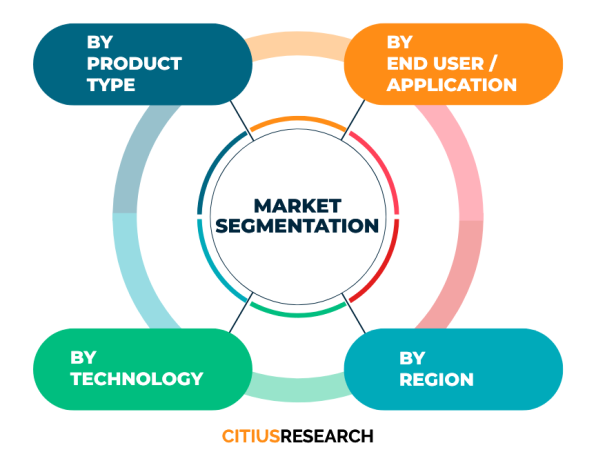
This comprehensive market report on the Airborne LiDAR market is meticulously segmented to provide a detailed and granular analysis of the industry landscape. The segmentation is designed to help stakeholders understand specific dynamics within different facets of the market. The report is first segmented by type, distinguishing between topographic LiDAR and bathymetric LiDAR systems, as their technology, applications, and end-user demands differ significantly. Further segmentation is done by component, analyzing the market for lasers, navigation and positioning systems, software, and other ancillary equipment, which is crucial for understanding the supply chain and innovation hotspots.
The application segment forms a core part of the analysis, breaking down the market into key uses such as corridor mapping, forestry, mining, construction, environmental monitoring, disaster management, and archaeology. This allows for an assessment of growth drivers and opportunities within each vertical. The platform segment categorizes the market into manned aircraft and unmanned aerial vehicles (drones), reflecting the shifting trends in data acquisition platforms. Geographically, the report provides a thorough regional analysis, covering North America, Europe, Asia-Pacific, Latin America, and the Middle East & Africa, with further breakdowns for key countries within these regions to highlight local trends, regulatory frameworks, and competitive scenarios. This multi-dimensional segmentation ensures that the report delivers actionable insights tailored to the specific interests of various market participants.
What is Airborne LiDAR and how does it work? Airborne LiDAR is a remote sensing method that uses light in the form of a pulsed laser to measure variable distances to the Earth. These light pulses?combined with other data recorded by the airborne system?generate precise, three-dimensional information about the shape of the Earth and its surface characteristics. A LiDAR system principally consists of a laser scanner, a Global Positioning System receiver, and an Inertial Measurement Unit. The laser scanner emits rapid pulses of light towards the ground, and the sensor measures the time it takes for each pulse to bounce back. Using the known speed of light, the system calculates the distance travelled. The GPS determines the aircraft's location, and the IMU records its orientation (roll, pitch, and yaw). By combining these datasets, highly accurate georeferenced elevation points are generated, forming a "point cloud" that represents the 3D structure of the scanned area.
What are the main advantages of using Airborne LiDAR over photogrammetry? While both are valuable remote sensing technologies, Airborne LiDAR offers several distinct advantages over traditional photogrammetry. Its primary benefit is the ability to penetrate vegetation canopy and capture data from the ground surface below, which is crucial for applications in forestry and terrain mapping in wooded areas. LiDAR is an active sensor, meaning it provides its own light source, allowing for data acquisition during night-time or in low-light conditions, unlike photogrammetry which relies on sunlight. It directly measures distances, resulting in highly accurate elevation data with less dependence on ground control points compared to photogrammetry. LiDAR also excels in capturing data over featureless areas like sand or snow where photogrammetry might struggle with a lack of visual texture. However, photogrammetry is often better at reproducing the visual appearance and texture of surfaces, so the technologies are frequently used together to complement each other's strengths.
Which industries are the primary users of Airborne LiDAR data? Airborne LiDAR data is utilized by a wide array of industries. The core users include government agencies for urban planning, floodplain mapping, and infrastructure development. The forestry industry relies on it for inventory management, biomass estimation, and harvest planning. The engineering and construction sector uses it for topographic surveying, corridor mapping for roads and pipelines, and volumetric calculations. The mining industry applies it for site planning, volume monitoring, and tailings dam management. Environmental agencies and consultants use it for coastal zone management, habitat mapping, and erosion studies. Additionally, it is increasingly used in archaeology for discovering hidden features, in agriculture for land management, and by utility companies for monitoring power lines and other assets. The advent of autonomous vehicles has also spurred significant R&D interest, although this primarily involves terrestrial systems.
What is the difference between topographic and bathymetric LiDAR? The fundamental difference between topographic and bathymetric LiDAR lies in their intended target and the laser wavelength used. Topographic LiDAR is designed for mapping land surfaces and uses a near-infrared laser (typically 1064 nm) that is reflected by the ground, buildings, and vegetation. It is used for creating digital elevation models, 3D city models, and for applications in forestry and engineering. Bathymetric LiDAR, on the other hand, is specialized for measuring underwater depths and mapping the seafloor or riverbeds. It utilizes a green laser light (typically 532 nm) because green light can penetrate water more effectively than other wavelengths. Many bathymetric systems are actually dual-laser systems, firing both an infrared laser (for the water surface and land) and a green laser (for the water column and bottom) simultaneously to provide a seamless transition from land to water. This makes them more complex and expensive than standard topographic systems.
How has the use of drones impacted the Airborne LiDAR market? The integration of LiDAR with Unmanned Aerial Vehicles has profoundly impacted the market, democratizing access and opening new applications. Drones have significantly reduced the cost of LiDAR data acquisition, making it feasible for smaller projects, research institutions, and consultancies that could not previously afford traditional manned aircraft surveys. They offer unparalleled flexibility, able to fly at lower altitudes and in more confined spaces, which results in the collection of extremely high-resolution data. Drone LiDAR enables rapid deployment and on-demand surveying, which is critical for time-sensitive applications like disaster response, construction progress monitoring, and agricultural assessment. This has spurred innovation in sensor miniaturization, leading to the development of lighter, more power-efficient LiDAR units specifically designed for UAV platforms. The drone segment is one of the fastest-growing within the airborne market, fostering new business models and service providers.
What are the key challenges in processing Airborne LiDAR data? Processing raw Airborne LiDAR data into usable information presents several challenges. The volume of data is immense, often comprising billions of points, requiring substantial computational power and efficient storage solutions. The primary processing steps include georeferencing the point cloud using GPS and IMU data, which must be done with high precision to ensure accuracy. A major task is point cloud classification, where algorithms or manual editors must separate points into categories like ground, vegetation, buildings, and power lines. This process can be complex and time-consuming, especially in areas with dense and complex features. Filtering noise and outliers from the data is another challenge. Furthermore, deriving final products like digital terrain models or 3D models requires specialized software and skilled operators. The industry is addressing these challenges through increased automation using machine learning algorithms, development of more user-friendly software, and cloud-based processing solutions that offer scalable computing resources.
Citius Research has developed a research report titled “Airborne LiDAR Market Report - Global Industry Analysis, Size, Share, Growth Trends, Regional Outlook, Competitive Strategies and Segment Forecasts 2024 - 2030” delivering key insights regarding business intelligence and providing concrete business strategies to clients in the form of a detailed syndicated report. The report details out the factors such as business environment, industry trend, growth opportunities, competition, pricing, global and regional market analysis, and other market related factors.
• Airborne LiDAR Market Potential
• Segment-wise breakup
• Compounded annual growth rate (CAGR) for the next 6 years
• Key customers and their preferences
• Market share of major players and their competitive strength
• Existing competition in the market
• Price trend analysis
• Key trend analysis
• Market entry strategies
• Market opportunity insights
The report focuses on the drivers, restraints, opportunities, and challenges in the market based on various factors geographically. Further, key players, major collaborations, merger & acquisitions along with trending innovation and business policies are reviewed in the report. The Airborne LiDAR Market report is segmented on the basis of various market segments and their analysis, both in terms of value and volume, for each region for the period under consideration.
• North America
• Latin America
• Europe
• MENA
• Asia Pacific
• Sub-Saharan Africa and
• Australasia
The report covers below mentioned analysis, but is not limited to:
• Overview of Airborne LiDAR Market
• Research Methodology
• Executive Summary
• Market Dynamics of Airborne LiDAR Market
• Driving Factors
• Restraints
• Opportunities
• Global Market Status and Forecast by Segment A
• Global Market Status and Forecast by Segment B
• Global Market Status and Forecast by Segment C
• Global Market Status and Forecast by Regions
• Upstream and Downstream Market Analysis of Airborne LiDAR Market
• Cost and Gross Margin Analysis of Airborne LiDAR Market
• Airborne LiDAR Market Report - Global Industry Analysis, Size, Share, Growth Trends, Regional Outlook, Competitive Strategies and Segment Forecasts 2024 - 2030
• Competition Landscape
• Market Share of Major Players
• Key Recommendations
The “Airborne LiDAR Market Report - Global Industry Analysis, Size, Share, Growth Trends, Regional Outlook, Competitive Strategies and Segment Forecasts 2024 - 2030” report helps the clients to take business decisions and to understand strategies of major players in the industry. The report delivers the market driven results supported by a mix of primary and secondary research. The report provides the results triangulated through authentic sources and upon conducting thorough primary interviews with the industry experts. The report includes the results on the areas where the client can focus and create point of parity and develop a competitive edge, based on real-time data results.
Below are the key stakeholders for the Airborne LiDAR Market:
• Manufacturers
• Distributors/Traders/Wholesalers
• Material/Component Manufacturers
• Industry Associations
• Downstream vendors
| Report Attribute | Details |
| Base year | 2023 |
| Historical data | 2018 – 2023 |
| Forecast | 2024 - 2030 |
| CAGR | 2024 - 2030 |
| Quantitative Units | Value (USD Million) |
| Report coverage | Revenue Forecast, Competitive Landscape, Growth Factors, Trends and Strategies. Customized report options available on request |
| Segments covered | Product type, technology, application, geography |
| Regions covered | North America, Latin America, Europe, MENA, Asia Pacific, Sub-Saharan Africa and Australasia |
| Countries covered | US, UK, China, Japan, Germany, India, France, Brazil, Italy, Canada, Russia, South Korea, Australia, Spain, Mexico and others |
| Customization scope | Available on request |
| Pricing | Various purchase options available as per your research needs. Discounts available on request |
• To describe and forecast the Airborne LiDAR Market size, on the basis of various segmentations and geography, in terms of value and volume
• To measure the changing needs of customers/industries
• To provide detailed information regarding the drivers, restraints, opportunities, and challenges influencing the growth of the market
• To gain competitive intelligence and uncover new opportunities
• To analyse opportunities in the market for stakeholders by identifying high-growth segments in Airborne LiDAR Market
• To strategically profile key players and provide details of the current competitive landscape
• To analyse strategic approaches adopted by players in the market, such as product launches and developments, acquisitions, collaborations, contracts, expansions, and partnerships
Citius Research provides free customization of reports as per your need. This report can be personalized to meet your requirements. Get in touch with our sales team, who will guarantee you to get a report that suits your necessities.

We follow a robust research methodology to analyze the market in order to provide our clients with qualitative and quantitative analysis which has a very low or negligible deviance. Extensive secondary research supported by primary data collection methods help us to thoroughly understand and gauge the market. We incorporate both top-down and bottom-up approach for estimating the market. The below mentioned methods are then adopted to triangulate and validate the market.
Secondary research includes sources such as published books, articles in journals, news media and published businesses, government and international body publications, and associations. Sources also include paid databases such as Hoovers, Thomson Reuters, Passport and others. Data derived through secondary sources is further validated through primary sources. The secondary sources also include major manufacturers mapped on the basis of revenues, product portfolios, and sales channels.
Primary data collection methods include conducting interviews with industry experts and various stakeholders across the supply chain, such as raw material suppliers, manufacturers, product distributors and customers. The interviews are either telephonic or face-to-face, or even a combination of both. Prevailing trends in the industry are gathered by conducting surveys. Primary interviews also help us to understand the market drivers, restraints and opportunities, along with the challenges in the market. This method helps us in validating the data gathered through secondary sources, further triangulating the data and developing it through our statistical tools. We generally conduct interviews with -
Supply side analysis is based on the data collected from the manufacturers and the product providers in terms of their segmental revenues. Secondary sources for this type of analysis include company annual reports and publications, associations and organisations, government publications and others.
Demand side analysis is based upon the consumer insights who are the end users of the particular product in question. They could be an individual user or an organisation. Such data is gathered through consumer surveys and focused group interviews.
As a primary step, in order to develop the market numbers we follow a vigorous methodology that includes studying the parent market of the niche product and understanding the industry trends, acceptance among customers of the product, challenges, future growth, and others, followed by further breaking down the market under consideration into various segments and sub-markets. Additionally, in order to cross-validate the market, we also determine the top players in the market, along with their segmental revenues for the said market. Our secondary sources help us to validate the market share of the top players. Using both the qualitative and quantitative analysis of all the possible factors helps us determine the market numbers which are inclined towards accuracy.
Request a detailed Research Methodology for the market.
Citius Research has developed a research report titled “Office Peripherals and Products Market Report - Global Industry Analysis, Size, Share, Growth Trends, Regional Outlook, Competitive Strategies and Segment ... Read More »
Citius Research has developed a research report titled “Cordless Phone Market Report - Global Industry Analysis, Size, Share, Growth Trends, Regional Outlook, Competitive Strategies and Segment Forecasts 2024 - ... Read More »
Citius Research has developed a research report titled “Wireless Phone Charger Market Report - Global Industry Analysis, Size, Share, Growth Trends, Regional Outlook, Competitive Strategies and Segment Forecasts... Read More »
Citius Research has developed a research report titled “HVDC Capacitor Market Report - Global Industry Analysis, Size, Share, Growth Trends, Regional Outlook, Competitive Strategies and Segment Forecasts 2024 - ... Read More »
Citius Research has developed a research report titled “Customer Satisfaction Software Market Report - Global Industry Analysis, Size, Share, Growth Trends, Regional Outlook, Competitive Strategies and Segment F... Read More »
The Pet Snacks and Treats Market is witnessing remarkable growth within the pet care sector, due to the rising demand for delectable and healthy treats for pet animals. This market provides pet owners with a vari... Read More »
The creatine gummies market represents a small but rising niche within the broader sports nutrition sector. Creatine gummies provide an alternative delivery format to powders for the muscle strength and performance bo... Read More »
Citius Research has developed a research report titled “Yield Monitoring Systems Market Report - Global Industry Analysis, Size, Share, Growth Trends, Regional Outlook, Competitive Strategies and Segment Forecas... Read More »
Citius Research has developed a research report titled “XRF Analyzer Market Report - Global Industry Analysis, Size, Share, Growth Trends, Regional Outlook, Competitive Strategies and Segment Forecasts 2024 - 20... Read More »
Citius Research has developed a research report titled “Wound Measurement Devices Market Report - Global Industry Analysis, Size, Share, Growth Trends, Regional Outlook, Competitive Strategies and Segment Foreca... Read More »