
Insured Buying
This report has a service guarantee. We stand by our report quality.
The Agricultural Mapping Services Market size was estimated at USD 850 million in 2023 and is projected to reach USD 1.55 billion by 2030, exhibiting a compound annual growth rate (CAGR) of 9.00% during the forecast period (2024-2030).
| Study Period | 2018 - 2030 |
| Base Year For Estimation | 2023 |
| Forecast Data Period | 2024 - 2030 |
| CAGR (2024-2030) | 9.00% |
| 2023 Market Size | USD 850 million |
| 2030 Market Size | USD 1.55 billion |
| Key Players | Trimble, John Deere, AGCO, Topcon, Raven |
The agricultural mapping services market represents a dynamic and rapidly evolving segment within the broader machinery and equipment industry, focused on providing advanced geospatial data and analytics to modernize farming practices. These services utilize technologies such as GPS, GIS, drones, satellites, and remote sensing to generate detailed maps that support precision agriculture. The primary objective is to enhance crop management, optimize resource utilization, and improve overall farm productivity. Key offerings include soil mapping, yield monitoring, crop health assessment, and irrigation planning, which collectively empower farmers and agribusinesses to make data-driven decisions. The market is characterized by a growing adoption of digital farming solutions, driven by the need to address global food security challenges and increasing environmental concerns. Major players in this space range from established technology firms to specialized agricultural service providers, all contributing to an innovative and competitive landscape. As agricultural operations worldwide continue to embrace smart farming techniques, the demand for sophisticated mapping services is expected to rise, fostering further technological advancements and market expansion.
The agricultural mapping services market is distinguished by several key highlights that underscore its significance and growth potential. One prominent feature is the integration of artificial intelligence and machine learning algorithms with mapping technologies, enabling predictive analytics for crop yield forecasting and disease detection. Another critical aspect is the proliferation of unmanned aerial vehicles (drones) equipped with high-resolution cameras and multispectral sensors, which provide cost-effective and timely aerial imagery for detailed field analysis. The market also benefits from increasing partnerships between agtech companies and traditional agricultural machinery manufacturers, facilitating the development of integrated solutions that combine mapping data with automated equipment. Furthermore, the emphasis on sustainability and resource conservation is driving the adoption of precision mapping to minimize water, fertilizer, and pesticide usage, aligning with global environmental goals. The expansion of cloud-based platforms for data storage and analysis allows for real-time access and collaboration among stakeholders, enhancing operational efficiency. These highlights collectively position agricultural mapping services as a cornerstone of modern agriculture, pivotal for achieving higher productivity and sustainable farming practices.
The agricultural mapping services market is influenced by a combination of drivers, opportunities, and restraints that shape its trajectory. Key drivers include the escalating global demand for food due to population growth, which necessitates improved agricultural efficiency and yield optimization. Technological advancements in remote sensing, GPS, and data analytics are also major drivers, making mapping services more accessible and effective. Additionally, supportive government initiatives and subsidies for precision agriculture adoption in various regions encourage market growth. Opportunities abound in the development of integrated solutions that combine mapping with other smart farming technologies, such as IoT sensors and automated machinery, creating comprehensive farm management systems. The untapped potential in emerging economies, where agricultural modernization is still in nascent stages, presents significant expansion prospects. However, the market faces restraints including high initial costs associated with advanced mapping technologies and equipment, which can be prohibitive for small-scale farmers. Data privacy and security concerns related to sensitive farm information also pose challenges. Moreover, the lack of technical expertise and digital literacy among farmers in certain regions may hinder widespread adoption. Addressing these restraints through cost-effective solutions and training programs is crucial for sustained market development.
The concentration of the agricultural mapping services market reveals a landscape with a mix of large multinational corporations and specialized niche players, each contributing to market dynamics. Geographically, North America and Europe exhibit high market concentration due to early adoption of precision agriculture technologies, strong infrastructure, and significant investments in R&D. In these regions, companies like John Deere, Trimble, and Topcon have established strong footholds, offering integrated mapping solutions as part of broader agricultural equipment portfolios. The Asia-Pacific region is experiencing rapid growth, driven by increasing government support and rising awareness about smart farming, leading to a more fragmented market with numerous local and international entrants. The market is also characterized by strategic collaborations and mergers, such as those between technology firms and agricultural giants, aiming to enhance product offerings and expand geographic reach. This concentration pattern indicates a competitive yet collaborative environment, where innovation and market penetration strategies are key to maintaining leadership. As the market evolves, we may see further consolidation as companies seek to leverage complementary strengths and capture larger market shares.
Agricultural mapping services can be categorized into several types based on the technology and methodology employed, each serving distinct purposes in farm management. Soil mapping is a fundamental type, providing detailed analysis of soil properties such as pH levels, nutrient content, and moisture, which guide fertilization and irrigation decisions. Yield mapping involves the use of sensors and GPS to record crop yield variations across fields, enabling farmers to identify high and low productivity zones and adjust practices accordingly. Crop health mapping utilizes multispectral and hyperspectral imagery from drones or satellites to detect stress, diseases, or nutrient deficiencies early, allowing for targeted interventions. Topographic mapping offers detailed elevation and contour information, essential for planning drainage, irrigation systems, and land leveling operations. Variable rate technology (VRT) mapping integrates with application equipment to enable precise input distribution based on mapped variability, optimizing resource use. Each type of mapping service provides critical data that enhances precision agriculture, contributing to more efficient and sustainable farming operations. The choice of mapping type often depends on specific farm needs, crop types, and technological accessibility.
Agricultural mapping services find applications across various facets of farm management, significantly enhancing efficiency and productivity. In crop monitoring and management, these services enable continuous observation of crop growth stages, health, and development, facilitating timely actions such as pest control or irrigation. Soil and field analysis applications involve detailed assessment of soil conditions and field characteristics, supporting informed decisions on planting patterns and soil treatment. Yield monitoring and mapping applications help in evaluating harvest outcomes, identifying yield variability, and planning for future seasons to maximize output. Irrigation management applications use mapping data to design and implement efficient water distribution systems, reducing water wastage and ensuring optimal crop hydration. Precision farming applications integrate multiple mapping data points to automate and optimize farming operations, such as seeding, fertilizing, and harvesting, using variable rate technology. Additionally, environmental monitoring applications assist in tracking and mitigating the impact of farming activities on surrounding ecosystems, promoting sustainable practices. These diverse applications demonstrate the versatility of agricultural mapping services in addressing various challenges faced by modern farmers, ultimately leading to more productive and environmentally conscious agriculture.
The adoption and development of agricultural mapping services vary significantly across regions, influenced by factors such as technological infrastructure, agricultural practices, and government policies. In North America, the market is highly advanced, driven by widespread adoption of precision agriculture, strong presence of key players, and substantial farm sizes that benefit from mapping technologies. The United States and Canada are leaders in implementing drone-based and satellite mapping for large-scale farming operations. Europe follows closely, with countries like Germany, France, and the United Kingdom emphasizing sustainable farming and supported by EU agricultural subsidies, leading to robust demand for mapping services. The Asia-Pacific region is emerging as a high-growth market, with countries such as China, India, and Australia increasingly investing in smart agriculture to enhance food security and farm productivity. Government initiatives promoting digital farming and the presence of a large agricultural base are key growth drivers here. Latin America, particularly Brazil and Argentina, is also adopting mapping services due to the dominance of large agribusinesses and focus on export-oriented agriculture. Meanwhile, the Middle East and Africa show nascent but growing interest, with potential fueled by need for efficient water management and agricultural development programs. These regional insights highlight the global nature of the market and the varying stages of adoption worldwide.
The agricultural mapping services market features a competitive array of companies, ranging from global technology giants to specialized agtech firms, each bringing unique strengths to the table. John Deere is a prominent player, leveraging its extensive dealer network and integration of mapping technologies into its machinery offerings, such as combines and tractors with built-in GPS and data analytics. Trimble Inc. provides comprehensive precision agriculture solutions, including advanced mapping software and hardware for field mapping and guidance. Topcon Corporation focuses on positioning technologies and offers mapping services that enhance farm efficiency through precise data collection and analysis. DJI, known for its drones, has made significant inroads by providing aerial imaging solutions tailored for agricultural mapping, enabling detailed crop and field analysis. Sentera specializes in ag analytics, offering drone-based mapping services that deliver actionable insights for crop health and management. Other notable companies include AGCO Corporation, which integrates mapping into its equipment through its Fuse? technologies, and Raven Industries, providing innovative mapping and autosteer systems. These companies compete on technology innovation, product reliability, and global reach, continuously advancing the capabilities of agricultural mapping services to meet evolving farmer needs.
The agricultural mapping services market has witnessed several recent developments that reflect ongoing innovation and strategic movements. Advancements in satellite imagery resolution and frequency have enhanced the ability to monitor crops in near real-time, with companies like Planet Labs and Airbus expanding their agricultural portfolios. Drone technology has seen significant improvements, with newer models offering longer flight times, better sensors, and automated flight planning, making aerial mapping more efficient and accessible. There is a growing trend towards the integration of artificial intelligence and machine learning into mapping platforms, enabling more accurate predictive analytics for yield forecasting and disease detection. Strategic partnerships and acquisitions have been prominent, such as collaborations between mapping service providers and agricultural input companies to create end-to-end solutions. For instance, partnerships focusing on combining soil data with seed and fertilizer recommendations are gaining traction. Additionally, increased investment in startups developing novel mapping algorithms and cloud-based data management platforms indicates a vibrant innovation ecosystem. These developments are driving the market towards more sophisticated, user-friendly, and integrated solutions, poised to further transform agricultural practices.
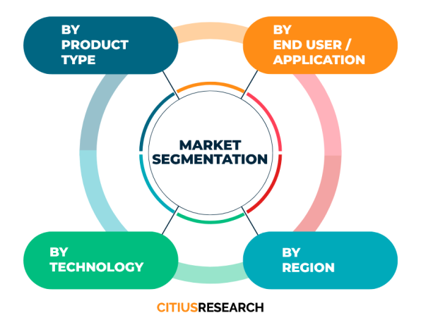
This report on the agricultural mapping services market is meticulously segmented to provide a comprehensive analysis that caters to the diverse needs of stakeholders. The segmentation is based on type, which includes soil mapping, yield mapping, crop health mapping, topographic mapping, and variable rate technology mapping, each examined for their market presence and growth prospects. Application segmentation covers key areas such as crop monitoring and management, soil and field analysis, yield monitoring, irrigation management, precision farming, and environmental monitoring, highlighting the specific uses and demand drivers for each application. The report also offers regional segmentation, delving into North America, Europe, Asia-Pacific, Latin America, and the Middle East and Africa, providing insights into regional trends, adoption rates, and competitive landscapes. Furthermore, the segmentation includes an analysis of leading companies, detailing their market share, product portfolios, and strategic initiatives. This structured approach ensures that readers gain a nuanced understanding of each market segment, enabling informed decision-making and identification of growth opportunities within the agricultural mapping services ecosystem.
What are agricultural mapping services? Agricultural mapping services involve the use of technologies like GPS, drones, satellites, and remote sensing to create detailed maps of farmland. These maps provide data on soil conditions, crop health, yield variability, and other factors, helping farmers optimize resource use and improve productivity through precision agriculture techniques.
How do drones help in agricultural mapping? Drones equipped with cameras and sensors capture high-resolution aerial imagery of fields. This imagery is used to generate maps that show variations in crop health, soil moisture, and nutrient levels. Drones offer a cost-effective and flexible solution for frequent monitoring, enabling timely interventions and detailed analysis.
What is the difference between GIS and GPS in agricultural mapping? GPS (Global Positioning System) provides precise location data, which is used to track field boundaries and guide machinery. GIS (Geographic Information System) is a software-based tool that analyzes and visualizes spatial data, such as soil types or yield maps, helping farmers make informed decisions based on geographic patterns.
Why is soil mapping important in agriculture? Soil mapping is crucial because it reveals variations in soil properties like pH, organic matter, and nutrient levels across a field. This information allows farmers to apply fertilizers and amendments precisely where needed, improving soil health, reducing input costs, and enhancing crop yields.
What are the benefits of yield mapping? Yield mapping involves recording harvest data along with GPS coordinates to create maps showing yield variations. Benefits include identifying high and low-performing areas, understanding the impact of management practices, and planning for future seasons to maximize productivity and profitability.
How does agricultural mapping support sustainable farming? Agricultural mapping promotes sustainability by enabling precise application of water, fertilizers, and pesticides, reducing waste and environmental impact. It helps monitor crop health early, minimizing chemical usage, and supports practices like conservation tillage and efficient irrigation, contributing to long-term ecological balance.
Citius Research has developed a research report titled “Agricultural Mapping Services Market Report - Global Industry Analysis, Size, Share, Growth Trends, Regional Outlook, Competitive Strategies and Segment Forecasts 2024 - 2030” delivering key insights regarding business intelligence and providing concrete business strategies to clients in the form of a detailed syndicated report. The report details out the factors such as business environment, industry trend, growth opportunities, competition, pricing, global and regional market analysis, and other market related factors.
• Agricultural Mapping Services Market Potential
• Segment-wise breakup
• Compounded annual growth rate (CAGR) for the next 6 years
• Key customers and their preferences
• Market share of major players and their competitive strength
• Existing competition in the market
• Price trend analysis
• Key trend analysis
• Market entry strategies
• Market opportunity insights
The report focuses on the drivers, restraints, opportunities, and challenges in the market based on various factors geographically. Further, key players, major collaborations, merger & acquisitions along with trending innovation and business policies are reviewed in the report. The Agricultural Mapping Services Market report is segmented on the basis of various market segments and their analysis, both in terms of value and volume, for each region for the period under consideration.
• North America
• Latin America
• Europe
• MENA
• Asia Pacific
• Sub-Saharan Africa and
• Australasia
The report covers below mentioned analysis, but is not limited to:
• Overview of Agricultural Mapping Services Market
• Research Methodology
• Executive Summary
• Market Dynamics of Agricultural Mapping Services Market
• Driving Factors
• Restraints
• Opportunities
• Global Market Status and Forecast by Segment A
• Global Market Status and Forecast by Segment B
• Global Market Status and Forecast by Segment C
• Global Market Status and Forecast by Regions
• Upstream and Downstream Market Analysis of Agricultural Mapping Services Market
• Cost and Gross Margin Analysis of Agricultural Mapping Services Market
• Agricultural Mapping Services Market Report - Global Industry Analysis, Size, Share, Growth Trends, Regional Outlook, Competitive Strategies and Segment Forecasts 2024 - 2030
• Competition Landscape
• Market Share of Major Players
• Key Recommendations
The “Agricultural Mapping Services Market Report - Global Industry Analysis, Size, Share, Growth Trends, Regional Outlook, Competitive Strategies and Segment Forecasts 2024 - 2030” report helps the clients to take business decisions and to understand strategies of major players in the industry. The report delivers the market driven results supported by a mix of primary and secondary research. The report provides the results triangulated through authentic sources and upon conducting thorough primary interviews with the industry experts. The report includes the results on the areas where the client can focus and create point of parity and develop a competitive edge, based on real-time data results.
Below are the key stakeholders for the Agricultural Mapping Services Market:
• Manufacturers
• Distributors/Traders/Wholesalers
• Material/Component Manufacturers
• Industry Associations
• Downstream vendors
| Report Attribute | Details |
| Base year | 2023 |
| Historical data | 2018 – 2023 |
| Forecast | 2024 - 2030 |
| CAGR | 2024 - 2030 |
| Quantitative Units | Value (USD Million) |
| Report coverage | Revenue Forecast, Competitive Landscape, Growth Factors, Trends and Strategies. Customized report options available on request |
| Segments covered | Product type, technology, application, geography |
| Regions covered | North America, Latin America, Europe, MENA, Asia Pacific, Sub-Saharan Africa and Australasia |
| Countries covered | US, UK, China, Japan, Germany, India, France, Brazil, Italy, Canada, Russia, South Korea, Australia, Spain, Mexico and others |
| Customization scope | Available on request |
| Pricing | Various purchase options available as per your research needs. Discounts available on request |
• To describe and forecast the Agricultural Mapping Services Market size, on the basis of various segmentations and geography, in terms of value and volume
• To measure the changing needs of customers/industries
• To provide detailed information regarding the drivers, restraints, opportunities, and challenges influencing the growth of the market
• To gain competitive intelligence and uncover new opportunities
• To analyse opportunities in the market for stakeholders by identifying high-growth segments in Agricultural Mapping Services Market
• To strategically profile key players and provide details of the current competitive landscape
• To analyse strategic approaches adopted by players in the market, such as product launches and developments, acquisitions, collaborations, contracts, expansions, and partnerships
Citius Research provides free customization of reports as per your need. This report can be personalized to meet your requirements. Get in touch with our sales team, who will guarantee you to get a report that suits your necessities.

We follow a robust research methodology to analyze the market in order to provide our clients with qualitative and quantitative analysis which has a very low or negligible deviance. Extensive secondary research supported by primary data collection methods help us to thoroughly understand and gauge the market. We incorporate both top-down and bottom-up approach for estimating the market. The below mentioned methods are then adopted to triangulate and validate the market.
Secondary research includes sources such as published books, articles in journals, news media and published businesses, government and international body publications, and associations. Sources also include paid databases such as Hoovers, Thomson Reuters, Passport and others. Data derived through secondary sources is further validated through primary sources. The secondary sources also include major manufacturers mapped on the basis of revenues, product portfolios, and sales channels.
Primary data collection methods include conducting interviews with industry experts and various stakeholders across the supply chain, such as raw material suppliers, manufacturers, product distributors and customers. The interviews are either telephonic or face-to-face, or even a combination of both. Prevailing trends in the industry are gathered by conducting surveys. Primary interviews also help us to understand the market drivers, restraints and opportunities, along with the challenges in the market. This method helps us in validating the data gathered through secondary sources, further triangulating the data and developing it through our statistical tools. We generally conduct interviews with -
Supply side analysis is based on the data collected from the manufacturers and the product providers in terms of their segmental revenues. Secondary sources for this type of analysis include company annual reports and publications, associations and organisations, government publications and others.
Demand side analysis is based upon the consumer insights who are the end users of the particular product in question. They could be an individual user or an organisation. Such data is gathered through consumer surveys and focused group interviews.
As a primary step, in order to develop the market numbers we follow a vigorous methodology that includes studying the parent market of the niche product and understanding the industry trends, acceptance among customers of the product, challenges, future growth, and others, followed by further breaking down the market under consideration into various segments and sub-markets. Additionally, in order to cross-validate the market, we also determine the top players in the market, along with their segmental revenues for the said market. Our secondary sources help us to validate the market share of the top players. Using both the qualitative and quantitative analysis of all the possible factors helps us determine the market numbers which are inclined towards accuracy.
Request a detailed Research Methodology for the market.
Citius Research has developed a research report titled “Yield Monitoring Systems Market Report - Global Industry Analysis, Size, Share, Growth Trends, Regional Outlook, Competitive Strategies and Segment Forecas... Read More »
Citius Research has developed a research report titled “XRF Analyzer Market Report - Global Industry Analysis, Size, Share, Growth Trends, Regional Outlook, Competitive Strategies and Segment Forecasts 2024 - 20... Read More »
Citius Research has developed a research report titled “Wound Measurement Devices Market Report - Global Industry Analysis, Size, Share, Growth Trends, Regional Outlook, Competitive Strategies and Segment Foreca... Read More »
Citius Research has developed a research report titled “Wire Tracer Market Report - Global Industry Analysis, Size, Share, Growth Trends, Regional Outlook, Competitive Strategies and Segment Forecasts 2024 - 203... Read More »
Citius Research has developed a research report titled “Wind Speed Alarm Market Report - Global Industry Analysis, Size, Share, Growth Trends, Regional Outlook, Competitive Strategies and Segment Forecasts 2024 ... Read More »
The Pet Snacks and Treats Market is witnessing remarkable growth within the pet care sector, due to the rising demand for delectable and healthy treats for pet animals. This market provides pet owners with a vari... Read More »
The creatine gummies market represents a small but rising niche within the broader sports nutrition sector. Creatine gummies provide an alternative delivery format to powders for the muscle strength and performance bo... Read More »
Citius Research has developed a research report titled “Yield Monitoring Systems Market Report - Global Industry Analysis, Size, Share, Growth Trends, Regional Outlook, Competitive Strategies and Segment Forecas... Read More »
Citius Research has developed a research report titled “XRF Analyzer Market Report - Global Industry Analysis, Size, Share, Growth Trends, Regional Outlook, Competitive Strategies and Segment Forecasts 2024 - 20... Read More »
Citius Research has developed a research report titled “Wound Measurement Devices Market Report - Global Industry Analysis, Size, Share, Growth Trends, Regional Outlook, Competitive Strategies and Segment Foreca... Read More »