
Insured Buying
This report has a service guarantee. We stand by our report quality.
The 3D Geographic Information System Market size was estimated at USD 11.5 billion in 2023 and is projected to reach USD 21.5 billion by 2030, exhibiting a compound annual growth rate (CAGR) of 9.30% during the forecast period (2024-2030).
| Study Period | 2018 - 2030 |
| Base Year For Estimation | 2023 |
| Forecast Data Period | 2024 - 2030 |
| CAGR (2024-2030) | 9.30% |
| 2023 Market Size | USD 11.5 billion |
| 2030 Market Size | USD 21.5 billion |
| Key Players | Esri, Autodesk, Hexagon, Trimble, Bentley Systems |
The 3D Geographic Information System (GIS) market represents a rapidly evolving segment within the semiconductor and electronics industry, characterized by the integration of advanced spatial data visualization and analysis technologies. This market focuses on systems that capture, store, manipulate, analyze, manage, and present spatial or geographic data in three dimensions, offering a more immersive and accurate representation of the real world compared to traditional 2D systems. The proliferation of sophisticated sensors, high-performance computing components, and advanced graphics processing units, largely driven by semiconductor innovation, has been instrumental in the development and adoption of 3D GIS solutions. These systems are increasingly critical for a wide range of professional applications, from urban planning and infrastructure development to environmental monitoring and defense, providing stakeholders with powerful tools for decision-making and strategic planning. The convergence of technologies such as IoT, AI, and machine learning with 3D GIS is further expanding its capabilities, enabling real-time data processing and predictive analytics. As organizations across both public and private sectors seek more detailed and dynamic spatial intelligence, the demand for robust 3D GIS platforms continues to grow, positioning this market as a key area of technological advancement and commercial opportunity within the broader electronics ecosystem.
The 3D GIS market is distinguished by several key technological and commercial highlights that underscore its significance. A primary highlight is the critical reliance on cutting-edge semiconductor components, including GPUs and specialized processors, which are essential for rendering complex 3D models and handling large volumetric datasets efficiently. Leading companies such as Esri, Hexagon, and Autodesk are at the forefront, developing software platforms that leverage these hardware advancements to deliver unparalleled visualization and analytical power. Another significant highlight is the integration of 3D GIS with Building Information Modeling (BIM), creating synergistic solutions for the architecture, engineering, and construction (AEC) industry that enhance project planning, execution, and facility management. The market is also witnessing a surge in cloud-based 3D GIS deployments, which offer scalability, remote accessibility, and reduced infrastructure costs for enterprises. Furthermore, the adoption of 3D GIS in smart city initiatives globally is a major trend, enabling urban planners to simulate scenarios, manage assets, and improve public services with greater precision. The emphasis on interoperability and open data standards is facilitating wider data exchange and collaboration across different platforms and stakeholders, which is crucial for the market's expansion and the development of comprehensive digital twins of physical environments.
The growth of the 3D GIS market is propelled by a combination of powerful drivers, alongside significant opportunities and notable restraints. A primary driver is the escalating demand for sophisticated spatial analysis and visualization tools across various sectors such as urban planning, defense, transportation, and natural resource management. The advancements in semiconductor technology, which provide the necessary computational power and graphics capabilities, are fundamental enablers, allowing for the processing of complex 3D geospatial data in real-time. The increasing availability of high-resolution satellite imagery, LiDAR data, and drone-captured information also acts as a strong driver, supplying the rich datasets required for detailed 3D modeling.
Substantial opportunities exist in the integration of 3D GIS with emerging technologies like Artificial Intelligence and the Internet of Things (IoT), which can automate data analysis, enhance predictive capabilities, and enable dynamic monitoring of infrastructure and environments. The expansion of smart city projects worldwide presents a vast opportunity for 3D GIS applications in urban management and citizen services. Additionally, the growing need for environmental monitoring and climate change analysis offers new avenues for market growth.
However, the market faces several restraints. The high cost associated with the acquisition and processing of 3D geospatial data, along with the substantial investment required for advanced hardware and software, can be a barrier to adoption, particularly for small and medium-sized enterprises. Data privacy and security concerns, especially when handling sensitive geographical information, also pose challenges. Furthermore, a shortage of skilled professionals proficient in both geospatial sciences and 3D technologies can restrain market expansion, necessitating increased investment in training and education.
The competitive landscape of the 3D GIS market is characterized by a concentration of well-established technology providers and a growing number of specialized innovators. The market is moderately concentrated, with a few major players holding significant shares due to their extensive product portfolios, strong R&D capabilities, and global presence. Companies like Esri, with its ArcGIS platform; Hexagon AB, through its Geospatial division; and Autodesk, known for its AEC and GIS solutions, dominate the market. These incumbents benefit from long-standing industry relationships, brand recognition, and the ability to offer integrated suites of geospatial products.
Alongside these giants, there is a vibrant ecosystem of smaller, niche players and startups that focus on specific applications or technologies, such as web-based 3D GIS, open-source solutions, or industry-specific tools. This diversity fosters innovation and caters to specialized market needs. The concentration is also influenced by strategic mergers and acquisitions, as larger companies seek to acquire novel technologies and expand their market reach. Geographically, North America and Europe exhibit a higher concentration of leading vendors and advanced users, although the Asia-Pacific region is rapidly emerging as a significant market with growing local and international player activity. The overall market dynamics suggest a trend towards consolidation, yet ample room remains for innovation and competition driven by technological advancements and evolving customer requirements.
The 3D GIS market can be segmented by type into software, hardware, and services, each playing a crucial role in the ecosystem. The software segment is the largest and most dynamic, encompassing the platforms and applications that enable the creation, visualization, analysis, and management of 3D geospatial data. This includes desktop GIS software, server-based systems, and increasingly, cloud-native and web-based applications that facilitate access and collaboration. Software solutions vary from comprehensive enterprise suites to specialized tools for tasks like 3D modeling, spatial analysis, and simulation.
The hardware segment is fundamentally supported by the semiconductor and electronics industry, providing the necessary infrastructure to run demanding 3D GIS applications. This includes high-performance workstations equipped with powerful GPUs from companies like NVIDIA and AMD, advanced servers for data processing and storage, and data collection devices such as LiDAR scanners, drones, and GPS units. The efficiency and capability of this hardware directly influence the performance and feasibility of complex 3D GIS operations.
The services segment includes implementation, consulting, training, support, and data processing services. As 3D GIS systems become more complex and integral to organizational operations, the demand for professional services to ensure successful deployment, integration, and utilization is growing significantly. This segment is essential for helping clients maximize the value of their 3D GIS investments, particularly in customizing solutions to meet specific industry needs.
The application of 3D GIS technology spans a diverse range of industries, each leveraging its capabilities to address specific challenges and objectives. In urban planning and smart city development, 3D GIS is indispensable for creating digital twins of cities, enabling planners to visualize urban landscapes, simulate the impact of new constructions, manage infrastructure assets, and optimize resource allocation for enhanced livability and sustainability. The architecture, engineering, and construction (AEC) sector extensively uses 3D GIS integrated with BIM for project design, visualization, clash detection, and lifecycle management of buildings and infrastructure projects, improving accuracy and reducing costs.
In the defense and intelligence sector, 3D GIS provides critical tools for mission planning, simulation, terrain analysis, and situational awareness, offering a realistic and detailed understanding of operational environments. The environmental management and natural resources industry utilizes these systems for monitoring ecosystems, analyzing climate change effects, managing water resources, and planning conservation efforts with greater spatial context. Additionally, the transportation sector applies 3D GIS for route planning, traffic management, and logistics optimization, while the telecommunications industry uses it for network planning and infrastructure deployment. The breadth of these applications demonstrates the transformative potential of 3D GIS technology across the global economy.
The adoption and development of the 3D GIS market exhibit distinct regional patterns influenced by technological infrastructure, regulatory frameworks, and economic priorities. North America, particularly the United States and Canada, represents a mature and leading market. This dominance is attributed to strong presence of key market players, high investment in R&D, advanced technological adoption across government and commercial sectors, and significant initiatives in defense, urban planning, and infrastructure development. The region's robust semiconductor industry also provides a solid foundation for the necessary hardware.
Europe is another significant market, characterized by stringent environmental regulations and strong government support for smart city and digital transformation projects, which drive the demand for advanced 3D GIS solutions. Countries like the UK, Germany, and France are at the forefront of adopting these technologies for urban management and environmental monitoring.
The Asia-Pacific region is anticipated to witness the fastest growth during the forecast period. Rapid urbanization, massive infrastructure investments, growing smart city initiatives in countries like China, India, Japan, and South Korea, and increasing government focus on geospatial technology for national development are key growth factors. The expanding electronics manufacturing base in this region also supports market growth. Latin America and the Middle East & Africa are emerging markets, with growth driven by increasing investments in urban development, transportation, and natural resource management, although adoption rates vary based on economic conditions and technological readiness.
The competitive landscape of the 3D GIS market features a mix of large, established corporations and innovative smaller firms. Esri is a globally recognized leader, renowned for its ArcGIS platform which offers comprehensive 3D capabilities through extensions like ArcGIS Pro and ArcGIS Urban, serving a vast customer base across government, utilities, and commercial sectors. Hexagon AB, through its Geospatial division (which includes Intergraph and Leica Geosystems), provides powerful 3D GIS solutions integrated with its sensor and software technologies, focusing on safety, infrastructure, and geospatial applications. Autodesk is a key player, especially in the AEC sector, with its GIS and BIM-integrated products like AutoCAD Map 3D and InfraWorks, enabling detailed infrastructure design and planning.
Other notable companies include Bentley Systems, which offers 3D GIS solutions for infrastructure engineering; Pitney Bowes with its Spectrum Spatial platform; and SuperMap Software, a significant player particularly in the Asian market. These companies compete on the basis of technology innovation, product performance, global reach, and industry-specific expertise. The market also sees active participation from specialized providers and startups focusing on cloud-based solutions, open-source platforms like Cesium, and applications in emerging areas such as virtual and augmented reality, contributing to a dynamic and competitive environment.
The 3D GIS market is characterized by continuous innovation and strategic movements. A prominent recent trend is the accelerated migration towards cloud-based and SaaS (Software-as-a-Service) models. Major vendors are heavily investing in cloud platforms to offer more scalable, accessible, and cost-effective solutions, enabling users to leverage powerful 3D GIS capabilities without significant upfront hardware investments. This shift is facilitating greater collaboration and data sharing among distributed teams.
Another significant development is the deepening integration of Artificial Intelligence and machine learning algorithms into 3D GIS platforms. These technologies are being used to automate the extraction of features from imagery and point clouds, perform predictive analytics on spatial data, and enhance the intelligence of digital twin models. Furthermore, there is a growing emphasis on improving interoperability and supporting open standards like 3D Tiles and I3S, which allow for seamless visualization and exchange of massive 3D geospatial datasets across different applications and platforms.
Strategic partnerships and acquisitions continue to shape the market landscape, as companies seek to expand their technological portfolios and geographic reach. For instance, collaborations between GIS software firms and cloud service providers are becoming increasingly common. Additionally, the application of 3D GIS in new domains such as autonomous vehicle navigation, augmented reality for field operations, and advanced climate modeling represents the cutting edge of market development, pushing the boundaries of what is possible with spatial data.
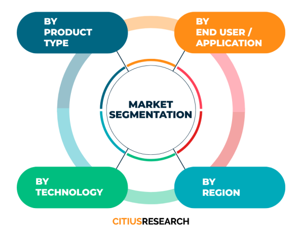
This comprehensive market research report on the 3D Geographic Information System market provides a detailed analysis structured through meticulous segmentation. The report is segmented by type, categorizing the market into software, hardware, and services. This allows for a clear understanding of the contribution and dynamics within each component of the 3D GIS ecosystem. Furthermore, the report is segmented by application, providing in-depth insights into the adoption and market trends across key sectors including urban planning and smart cities, architecture, engineering and construction (AEC), defense and intelligence, environmental monitoring, transportation, telecommunications, and others. This application-based analysis highlights the specific drivers, requirements, and growth prospects within each vertical.
Geographically, the report offers a thorough regional analysis, segmenting the global market into key regions: North America, Europe, Asia-Pacific, Latin America, and the Middle East & Africa. Each regional segment is examined in terms of market trends, key players, government initiatives, and growth potential, providing stakeholders with a clear view of geographical opportunities. This multi-dimensional segmentation ensures that the report delivers targeted and actionable intelligence for businesses, investors, and strategists looking to understand the nuances of the 3D GIS market and make informed decisions.
What is a 3D Geographic Information System (GIS)?
A 3D Geographic Information System is an advanced framework for gathering, managing, analyzing, and visualizing spatial data in three dimensions. Unlike traditional 2D GIS, it incorporates elevation and depth, allowing for the creation of realistic models of the environment, infrastructure, and objects, which is crucial for detailed analysis and planning in various industries.
How is 3D GIS different from BIM?
While both 3D GIS and Building Information Modeling (BIM) deal with three-dimensional data, they serve different primary purposes. BIM focuses on the detailed design, construction, and management of individual buildings and structures, containing rich information about building components. 3D GIS, on the other hand, operates at a broader scale, managing and analyzing spatial data about the natural and built environment surrounding those structures, such as terrain, infrastructure networks, and land use. They are increasingly being integrated for comprehensive project lifecycle management.
What are the main applications of 3D GIS?
3D GIS has a wide array of applications across numerous sectors. Key uses include urban planning and smart city development for creating digital twins and simulating urban growth; defense and intelligence for mission planning and terrain analysis; environmental management for monitoring ecosystems and natural disasters; and the architecture, engineering, and construction industry for site analysis and project visualization integrated with BIM. It is also vital in transportation, utilities, and telecommunications for network planning and management.
What are the key drivers for the growth of the 3D GIS market?
The growth of the 3D GIS market is primarily driven by the increasing demand for advanced spatial analysis and realistic visualization in decision-making processes. Technological advancements in semiconductors, which enable powerful computing and graphics processing, are fundamental drivers. The proliferation of data sources like LiDAR and drones, the rise of smart city projects globally, and the integration with technologies like AI and IoT for predictive analytics are also significant factors propelling the market forward.
Which industries are the major end-users of 3D GIS technology?
The major end-user industries for 3D GIS technology include government and public sector agencies for urban planning and defense; architecture, engineering, and construction; utilities and energy for infrastructure management; environmental agencies and natural resource companies; transportation and logistics firms; and the telecommunications sector. These industries leverage 3D GIS for enhanced planning, operational efficiency, and strategic analysis.
What are the challenges associated with implementing 3D GIS?
Implementing 3D GIS presents several challenges. These include the high cost associated with software licenses, specialized hardware like powerful GPUs, and data acquisition through technologies like LiDAR. There is also the technical complexity of processing and managing large, complex 3D datasets. A significant challenge is the shortage of skilled professionals with expertise in both geospatial science and 3D technologies. Additionally, issues related to data privacy, security, and ensuring interoperability between different systems and data formats can pose obstacles to implementation.
Citius Research has developed a research report titled “3D Geographic Information System Market Report - Global Industry Analysis, Size, Share, Growth Trends, Regional Outlook, Competitive Strategies and Segment Forecasts 2024 - 2030” delivering key insights regarding business intelligence and providing concrete business strategies to clients in the form of a detailed syndicated report. The report details out the factors such as business environment, industry trend, growth opportunities, competition, pricing, global and regional market analysis, and other market related factors.
• 3D Geographic Information System Market Potential
• Segment-wise breakup
• Compounded annual growth rate (CAGR) for the next 6 years
• Key customers and their preferences
• Market share of major players and their competitive strength
• Existing competition in the market
• Price trend analysis
• Key trend analysis
• Market entry strategies
• Market opportunity insights
The report focuses on the drivers, restraints, opportunities, and challenges in the market based on various factors geographically. Further, key players, major collaborations, merger & acquisitions along with trending innovation and business policies are reviewed in the report. The 3D Geographic Information System Market report is segmented on the basis of various market segments and their analysis, both in terms of value and volume, for each region for the period under consideration.
• North America
• Latin America
• Europe
• MENA
• Asia Pacific
• Sub-Saharan Africa and
• Australasia
The report covers below mentioned analysis, but is not limited to:
• Overview of 3D Geographic Information System Market
• Research Methodology
• Executive Summary
• Market Dynamics of 3D Geographic Information System Market
• Driving Factors
• Restraints
• Opportunities
• Global Market Status and Forecast by Segment A
• Global Market Status and Forecast by Segment B
• Global Market Status and Forecast by Segment C
• Global Market Status and Forecast by Regions
• Upstream and Downstream Market Analysis of 3D Geographic Information System Market
• Cost and Gross Margin Analysis of 3D Geographic Information System Market
• 3D Geographic Information System Market Report - Global Industry Analysis, Size, Share, Growth Trends, Regional Outlook, Competitive Strategies and Segment Forecasts 2024 - 2030
• Competition Landscape
• Market Share of Major Players
• Key Recommendations
The “3D Geographic Information System Market Report - Global Industry Analysis, Size, Share, Growth Trends, Regional Outlook, Competitive Strategies and Segment Forecasts 2024 - 2030” report helps the clients to take business decisions and to understand strategies of major players in the industry. The report delivers the market driven results supported by a mix of primary and secondary research. The report provides the results triangulated through authentic sources and upon conducting thorough primary interviews with the industry experts. The report includes the results on the areas where the client can focus and create point of parity and develop a competitive edge, based on real-time data results.
Below are the key stakeholders for the 3D Geographic Information System Market:
• Manufacturers
• Distributors/Traders/Wholesalers
• Material/Component Manufacturers
• Industry Associations
• Downstream vendors
| Report Attribute | Details |
| Base year | 2023 |
| Historical data | 2018 – 2023 |
| Forecast | 2024 - 2030 |
| CAGR | 2024 - 2030 |
| Quantitative Units | Value (USD Million) |
| Report coverage | Revenue Forecast, Competitive Landscape, Growth Factors, Trends and Strategies. Customized report options available on request |
| Segments covered | Product type, technology, application, geography |
| Regions covered | North America, Latin America, Europe, MENA, Asia Pacific, Sub-Saharan Africa and Australasia |
| Countries covered | US, UK, China, Japan, Germany, India, France, Brazil, Italy, Canada, Russia, South Korea, Australia, Spain, Mexico and others |
| Customization scope | Available on request |
| Pricing | Various purchase options available as per your research needs. Discounts available on request |
• To describe and forecast the 3D Geographic Information System Market size, on the basis of various segmentations and geography, in terms of value and volume
• To measure the changing needs of customers/industries
• To provide detailed information regarding the drivers, restraints, opportunities, and challenges influencing the growth of the market
• To gain competitive intelligence and uncover new opportunities
• To analyse opportunities in the market for stakeholders by identifying high-growth segments in 3D Geographic Information System Market
• To strategically profile key players and provide details of the current competitive landscape
• To analyse strategic approaches adopted by players in the market, such as product launches and developments, acquisitions, collaborations, contracts, expansions, and partnerships
Citius Research provides free customization of reports as per your need. This report can be personalized to meet your requirements. Get in touch with our sales team, who will guarantee you to get a report that suits your necessities.

We follow a robust research methodology to analyze the market in order to provide our clients with qualitative and quantitative analysis which has a very low or negligible deviance. Extensive secondary research supported by primary data collection methods help us to thoroughly understand and gauge the market. We incorporate both top-down and bottom-up approach for estimating the market. The below mentioned methods are then adopted to triangulate and validate the market.
Secondary research includes sources such as published books, articles in journals, news media and published businesses, government and international body publications, and associations. Sources also include paid databases such as Hoovers, Thomson Reuters, Passport and others. Data derived through secondary sources is further validated through primary sources. The secondary sources also include major manufacturers mapped on the basis of revenues, product portfolios, and sales channels.
Primary data collection methods include conducting interviews with industry experts and various stakeholders across the supply chain, such as raw material suppliers, manufacturers, product distributors and customers. The interviews are either telephonic or face-to-face, or even a combination of both. Prevailing trends in the industry are gathered by conducting surveys. Primary interviews also help us to understand the market drivers, restraints and opportunities, along with the challenges in the market. This method helps us in validating the data gathered through secondary sources, further triangulating the data and developing it through our statistical tools. We generally conduct interviews with -
Supply side analysis is based on the data collected from the manufacturers and the product providers in terms of their segmental revenues. Secondary sources for this type of analysis include company annual reports and publications, associations and organisations, government publications and others.
Demand side analysis is based upon the consumer insights who are the end users of the particular product in question. They could be an individual user or an organisation. Such data is gathered through consumer surveys and focused group interviews.
As a primary step, in order to develop the market numbers we follow a vigorous methodology that includes studying the parent market of the niche product and understanding the industry trends, acceptance among customers of the product, challenges, future growth, and others, followed by further breaking down the market under consideration into various segments and sub-markets. Additionally, in order to cross-validate the market, we also determine the top players in the market, along with their segmental revenues for the said market. Our secondary sources help us to validate the market share of the top players. Using both the qualitative and quantitative analysis of all the possible factors helps us determine the market numbers which are inclined towards accuracy.
Request a detailed Research Methodology for the market.
The Global U.S. & Asia Mobile Data and Value-Added Services to Support Telecom Growth Market size was valued at $XX billion in 2023, and is anticipated to reach $XX billion by 2030, growing at a CAGR of XX% during the... Read More »
Citius Research has developed a research report titled “Micromachining Market Report - Global Industry Analysis, Size, Share, Growth Trends, Regional Outlook, Competitive Strategies and Segment Forecasts 2024 - ... Read More »
Citius Research has developed a research report titled “Powder Injection Molding Market Report - Global Industry Analysis, Size, Share, Growth Trends, Regional Outlook, Competitive Strategies and Segment Forecas... Read More »
Citius Research has developed a research report titled “DC-DC Converter Market Report - Global Industry Analysis, Size, Share, Growth Trends, Regional Outlook, Competitive Strategies and Segment Forecasts 2024 -... Read More »
Citius Research has developed a research report titled “Security Equipment Market Report - Global Industry Analysis, Size, Share, Growth Trends, Regional Outlook, Competitive Strategies and Segment Forecasts 202... Read More »
The Pet Snacks and Treats Market is witnessing remarkable growth within the pet care sector, due to the rising demand for delectable and healthy treats for pet animals. This market provides pet owners with a vari... Read More »
The creatine gummies market represents a small but rising niche within the broader sports nutrition sector. Creatine gummies provide an alternative delivery format to powders for the muscle strength and performance bo... Read More »
Citius Research has developed a research report titled “Yield Monitoring Systems Market Report - Global Industry Analysis, Size, Share, Growth Trends, Regional Outlook, Competitive Strategies and Segment Forecas... Read More »
Citius Research has developed a research report titled “XRF Analyzer Market Report - Global Industry Analysis, Size, Share, Growth Trends, Regional Outlook, Competitive Strategies and Segment Forecasts 2024 - 20... Read More »
Citius Research has developed a research report titled “Wound Measurement Devices Market Report - Global Industry Analysis, Size, Share, Growth Trends, Regional Outlook, Competitive Strategies and Segment Foreca... Read More »